
products – Software
SpeakÆpp
Kopland has developed SpeakÆpp — a mobile app for pronunciation training in Norwegian, English, and French. SpeakÆpp is available on the App Store and Google Play and is designed for learners, educators, and speech professionals who want to improve pronunciation through targeted exercises.
SpeakÆpp is developed using React Native and Expo. It implements OAuth2 authentication and uses RevenueCat for in-app purchase paywalls. Firebase is used for storage and database management. The linguistic content is developed by PhD in Phonetics, Øydis Hide please refer: Snakketøy
Kopland Map
Kopland is developing a mapping solution that is already operational. It uses React and Next.js with Leaflet, and is hosted on Vercel in Washington DC. The link below leads to the map:
Maps are fetched from multiple tile servers. The routing engine (Java API) runs behind a secure NGINX reverse proxy at Kamatera in Stockholm. Forest roads, dirt roads, and private roads (Norway only) are retrieved directly from NVDB per county and cached (encrypted) in the browser to reduce NVDB load.
Dirt road and barrier data are obtained from global open-source APIs. The Kopland map can generate routes based on custom profiles. A gravel-riding profile prioritizes dirt roads and avoids non-payable barriers, while routing through payable ones.
Additional profiles exist for walking, cycling, and driving. More will be added based on testing and user feedback. Routes can be exported in GPX format for use in mobile apps such as GuruMap, OSMAND, or DMD2. Route import will also be supported, useful for sharing TET (Trans Euro Trail) and other tracks.
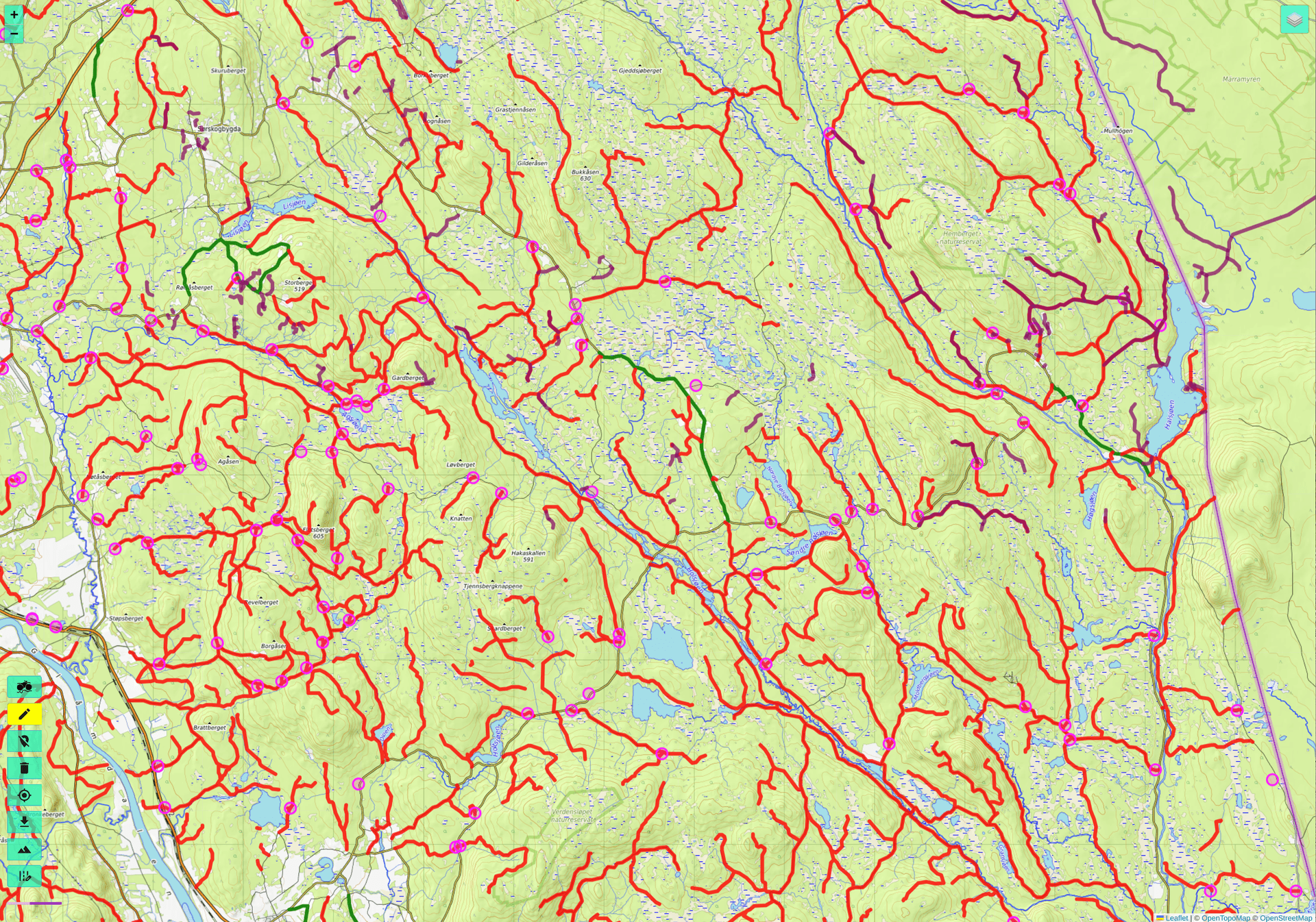
Gravel roads from NVDB.
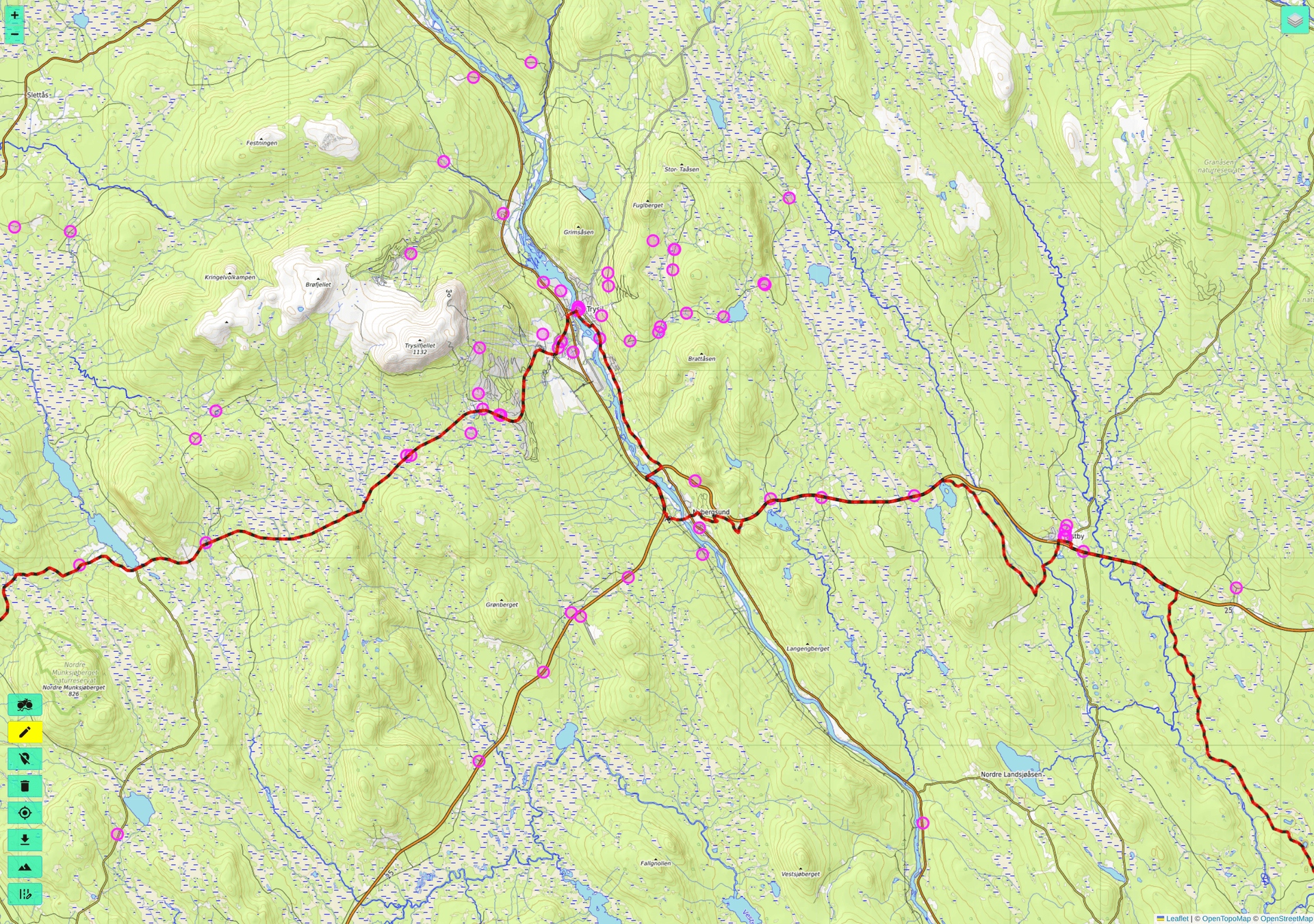
Barriers (circles) and a gravel route (dashed line)